



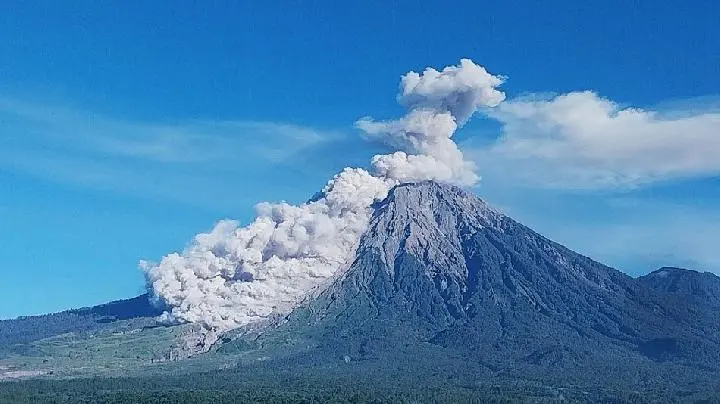
TEMPO.CO, Jakarta - Thin ash rain fell in several areas in Lumajang Regency following the eruption of Mount Semeru in Indonesia on Wednesday morning, just before dawn on July 15, 2026. The eruption, recorded around 04:19 AM local time, spewed volcanic ash up to 1 kilometer above the summit.
The Semeru Volcano Observatory (PGA) in Mount Sawur, Sumber Wuluh Village, Candipuro District, Lumajang Regency, reported that the observed ash column appeared white to gray with thick intensity towards the northeast. "The eruption was recorded on seismographs with a maximum amplitude of 22 mm and a duration of 204 seconds," said PGA Semeru officer Sigit Rian Alfian in a written report on Wednesday.
Meanwhile, based on the observation of seismic activity over the last six hours until Wednesday morning at 06:00 AM local time, there were 12 instances of eruption tremors with amplitudes of 10-22 mm and durations of 73-204 seconds. There were also 7 rockfall tremors with amplitudes of 1-5 mm and durations of 54-91 seconds.
The PGA Semeru also recorded 4 instances of blast tremors with amplitudes of 2-7 mm and durations of 51-64 seconds. In addition, there were 6 harmonic tremors with amplitudes of 1-15 mm and durations of 97-539 seconds. Distant tectonic tremors were recorded once with an amplitude of 12 mm, S-P 19 seconds, and a duration of 64 seconds.
Furthermore, the recapitulation of Mount Semeru's seismic activities on July 14, 2026, recorded 79 tremors within 24 hours, consisting of 53 eruption tremors, 16 rockfall tremors, 8 blast tremors, and 1 tremor.
The Acting Head of the Regional Disaster Management Agency (BPBD) of Lumajang Regency, Isnugroho, stated that the alert status for the highest volcano in Java is still at level III. He mentioned that based on the seismic data, there is still the potential for eruptive events such as pyroclastic flows. He also revealed that since Saturday, July 11, 2026, volcanic dust has been directed towards Lumajang City, resulting in thin ash rainfall. "We advise users of two-wheeled vehicles to wear masks," he said on Wednesday.
Under this alert status, the Center for Volcanology and Geological Hazard Mitigation (PVMBG) issued several recommendations, including refraining from any activities in the southeast sector along Besuk Kobokan, up to 13 kilometers from the peak (eruption center).
Beyond this distance, people are advised not to engage in activities within 500 meters from the edge of the river (river boundary) along Besuk Kobokan, as there is the potential for being affected by expanding pyroclastic flows and lava up to 17 kilometers from the peak.
In addition, residents are urged not to be active within a 5-kilometer radius from the crater/peak of Mount Semeru due to the risk of being hit by flying rocks. They are also asked to be cautious of potential pyroclastic flows, and lava flows along river valleys originating from the peak of Mount Semeru, especially along Besuk Kobokan, Besuk Bang, Besuk Kembar, and Besuk Sat, as well as the potential for lahar in small rivers which are tributaries of the Besuk Kobokan river.
Read: Mount Semeru Hit by 583 Eruptive Earthquake in Late May